


India and the United States are set to launch the world’s most advanced Earth-observing satellite, the NASA-ISRO Synthetic Aperture Radar (NISAR), on July 30, 2025, at 5:40 PM IST. The mission will lift off from the Satish Dhawan Space Centre, Sriharikota, using the GSLV-F16 rocket developed by the Indian Space Research Organisation.
The 27.5-hour countdown began at 2:10 PM IST on July 29, as confirmed by ISRO on X (formerly Twitter), marking the final stretch of a mission over a decade in the making. This will be the 18th flight of the GSLV and notably the first time the GSLV Mk II is used to place a satellite into sun-synchronous orbit (SSO)—a significant departure from its usual geostationary missions.
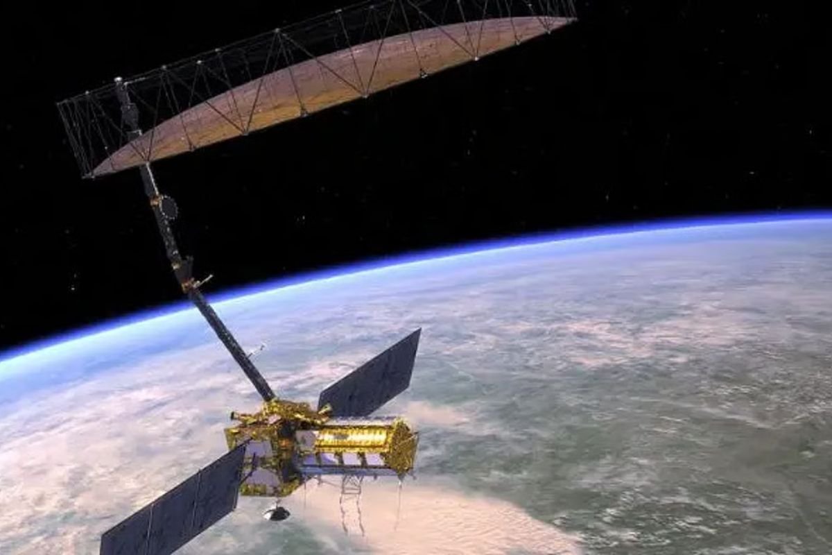
A $1.5 Billion Scientific Marvel
At a staggering cost of $1.5 billion, NASA-ISRO Synthetic Aperture Radar (NISAR) is the most expensive Earth observation mission to date. Weighing approximately 2,393 kilograms, it carries a cutting-edge dual-frequency radar payload—a NASA-developed L-band radar and an ISRO-developed S-band radar—mounted on a massive 12-meter deployable antenna.
These technologies will allow NISAR to scan the entire planet every 12 days, offering day-and-night, all-weather, and centimeter-level precision monitoring of Earth’s surface. It will capture crucial data on glacial retreat, deforestation, land subsidence, natural disasters, and ocean circulation, with applications ranging from climate modeling to agriculture and disaster resilience.
The mission’s objectives are ambitious: to track subtle shifts in the Earth’s crust, map changes in vegetation, monitor the melting of polar ice, and study dynamic natural phenomena with unprecedented accuracy. Its real-time data delivery is poised to significantly enhance global understanding of environmental changes and hazards.
Strategic Significance and the Road Ahead
More than a scientific milestone, NASA-ISRO Synthetic Aperture Radar (NISAR) exemplifies the growing Indo-U.S. strategic partnership in space exploration. Developed collaboratively by NASA’s Jet Propulsion Laboratory and ISRO, the mission represents years of joint innovation, design, and technology transfer between the two space powers.
Post-launch, NISAR will enter orbit approximately 747 kilometers above Earth within 19 minutes, followed by a 90-day commissioning phase. Once operational, it will orbit Earth 14 times daily, scanning nearly every point on land and ice sheets twice every 12 days.
The mission is also noteworthy for its open data policy—NISAR’s valuable insights will be freely available to scientists, institutions, and governments around the world. From early flood warnings to crop health monitoring, its real-world impact will extend far beyond the scientific community.
In essence, NASA-ISRO Synthetic Aperture Radar (NISAR) is not just a satellite—it is a symbol of international cooperation and a powerful tool in the fight against climate change and environmental degradation. As it prepares to launch, the world watches with anticipation for the profound changes this mission promises to bring.
Visit Business Viewpoint Magazine For The Most Recent Information.